


A summary of our full case study report outlining the works and options considered to mitigate risk from the historical disused landfill in the Lower Otter Valley floodplain. Many landfill sites are located within or near coastal areas and predate environmental and waste management regulations. These are now at risk due to climate change and erosion.
The Lower Otter restoration project has been studied over several years by our project team. It is not a surprise that development and historical human threat can be found within the floodplain. A known historical disused landfill is located along South Farm Road, in the middle of the floodplain. This is not unusual as many disused landfill sites are located within or near coastal areas and predate environmental and waste management regulations. These are now at risk due to climate change and erosion.
In the Lower Otter, the landfill was implemented in 1928, and has been extended over the years. It was closed in 1978. Whilst its content is not well documented, Clinton Devon Estates have records on its development and its uses over the years. Whilst some of the archives describe the detritus, the type of waste buried is not known for certain and waste management during this period was not fully understood. The tip was also at risk of fluvial flood and its consequences (erosion, potential release of contaminants) during and after its closure.
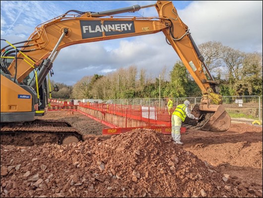
The project team had different options on how to secure the landfill, dependent on whether a full-scale restoration or a more localised restoration of the floodplain was chosen. As the scope of the Lower Otter restoration project was defined and the type of restoration of Big and Little Marsh was selected, it determined that the landfill needed to be partially removed to allow the reconnection of North Big Marsh and South Big Marsh.
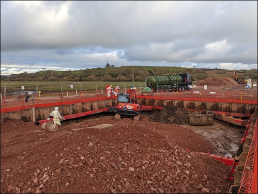
Ground investigations were commissioned to understand the content of the landfill which would inform the design and allow the mitigation of any risks related to the landfill. Some of the landfill was removed to allow the construction of a bridge and secure South Farm Road, the rest of the landfill was capped to ensure better protection. The design choice also enhances the landfill, using it as an area for the public to walk and observe the wildlife of the valley.
The choice of design meant that fewer risks needed to be mitigated during construction and safe methods of work were implemented to avoid disrupting the content of the landfill.
More importantly studies were undertaken to understand the impact of tidal inundation and climate change on the landfill. Results showed that the landfill was adequately protected after the project implementation, and the work not only allows protection against tidal inundation but also against fluvial floods, which was not the case before the project.
Finally, disused landfills leave a legacy to the future generation. The PACCo project and the Lower Restoration project don’t only secure the disused landfill but also demonstrate to stakeholders the possibility of remedying the problem. A full case study is available on the PACCo website which describes and details the history of the landfill, the engagement and how the location of the tip was considered through the different steps of the project, from the planning of the project through its conception and construction to its ongoing maintenance.