


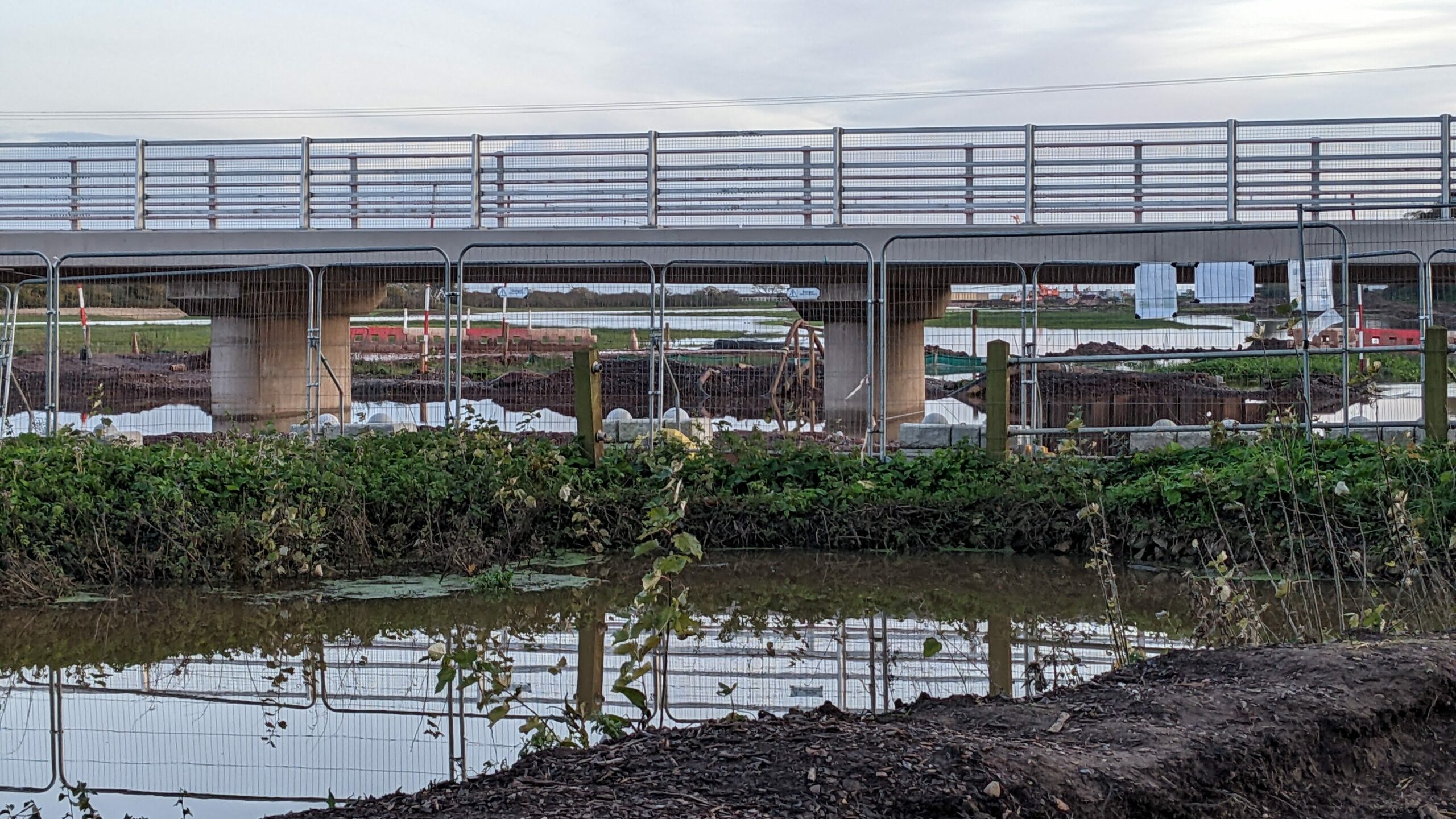
As the Lower Otter Restoration Project (LORP) moves towards its final exciting stages before completion, involving the opening of the new, raised road bridge on South Farm Road, and the breach of the embankments, it is interesting to consider how much of this work represents a reversal of previous ‘improvements’ by generations determined to engineer the landscape for their advantage.
The Clinton Devon Estates (the Estate) are particularly fortunate in having an archive which charts in detail the modifications of the last 250 years, both those completed, and a few mad cap ideas planned but never carried out.
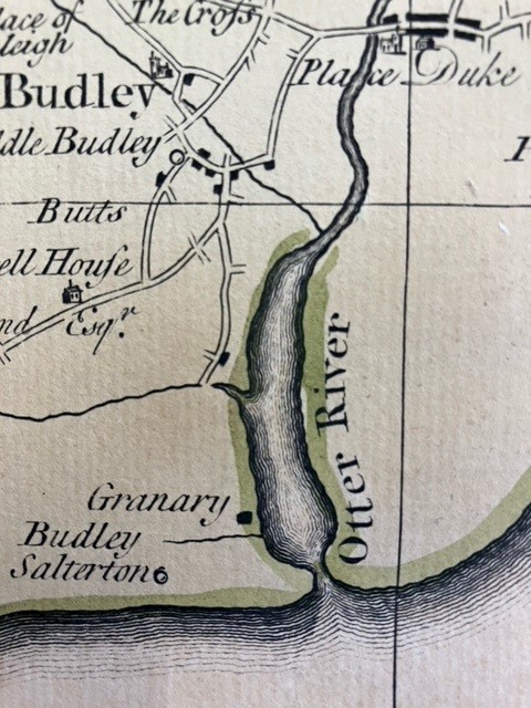
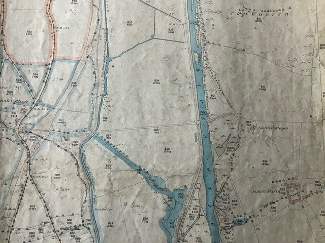
An illustration of this enthusiasm to improve conditions for man is the significant change brought about by the building of the embankments in the early 1800s. Take the example of the bridges over the River Otter – before the embankments led to drier conditions in the Runnie (the name given to the marshland at the Otter Estuary), the first bridge crossing was at Otterton, two miles upriver. Looking at this map of 1765, the reason is clear, the river was simply too wide to span below this point.
Even now it has been a major engineering project to build up the existing South Farm Road and insert a new bridge at its western end to allow the re-instatement of the river’s natural flood plain, while ensuring safe passage across the valley.
This level of engineering would not have been possible in the early nineteenth century, and so the eastern side of the river had no settlements below Otterton. At the eastern end of the road is White Bridge, which has been in place in various forms for many years. This photograph, taken at the time of the floods in November 2012 shows how the road flooded badly but the bridge remained above water.

So, when did this all change? The range of historic maps in the Estate’s archive illustrate the development of roads and bridges in the area along with the establishment of new farms, and the expansion of population centres. These were used extensively to inform LORP, and show the emergence of South Farm Road and the bridge that was variously known as Otter Bridge, South Bridge, and finally, White Bridge.
The big change came about as a result of the construction of the embankments in the early 1810s and they were sold as an idea to Lord Rolle (the Rolle family later married into the family of the Barons Clinton) by James Green. He produced an intricate plan of the river meandering across the marsh with the works needed to drain the Runnie for agricultural land, straightening parts of the river to form a canal, and enhancing the navigation of the river. Both measures stood to boost the area economically as food prices at the time were rising and canals were all the rage as a new form of transport in this pre-railway era. Below shows the original course of the river close to where White Bridge now stands with his ambitious plan for narrowing it to make a bridge crossing feasible.

Successive maps show a bridge and pathway in place providing the communities of Kersbrook and Budleigh Salterton with a short route to the eastern side of the river. By the time the tithe map for the parish of Otterton was drawn up, a bridge was in place and a trackway leading to South Farm, built in 1802. Previously, the land was farmed as part of Otterton Barton with the farmhouse in Otterton itself.
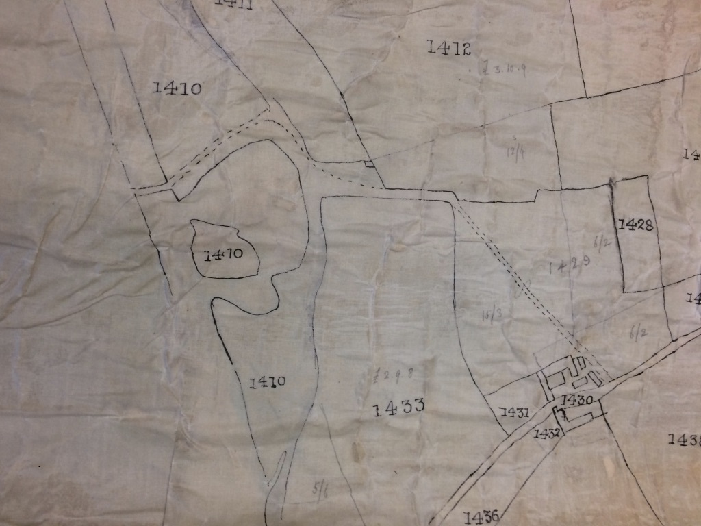
Later still, the first edition 25” ordnance survey plan shows clearly the straight road crossing the valley, over the bridge and curving round past South Farm Cottages to South Farm itself, just as it does today. This remains the only route for vehicles across the river without going north to Otterton.
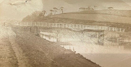
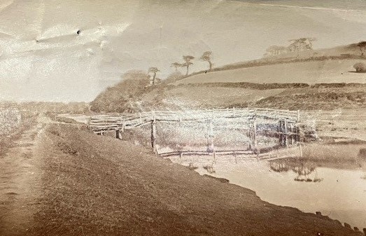
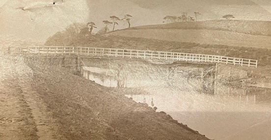
The bridge must have been an asset for the area easing communication between the east and west banks, but these photographs of c.1880 show it was a modest and rickety affair, more like an illustration in a children’s story book than a load-bearing bridge. It was likely used by people on foot and packhorses only, and was certainly under water when the river was in flood.
Soon after, in September 1888, it was replaced by a more serviceable bridge with distinctive white wooden boards, which is probably when it underwent a name change to White Bridge. The bridge was swept away in the exceptional floods in February 1930 but was rebuilt in much the same style and replaced with a concrete bridge in the 1960s.
Plans for another bridge over the Estuary were discussed in the 1880s. It was meant to stretch from the end of the shingle bar to the eastern cliff right on the sea edge and was proposed by the Rolle Estate as a public amenity. It was probably always an impractical suggestion to produce a stable bridge in the shifting pebbles, especially as the design would require a movable bridge to accommodate the masts of mackerel boats running for shelter in storms. Although the idea would be highly popular with visitors to Budleigh Salterton today, it was rejected at the time by Budleigh Salterton’s Board of Health, Exeter City Council, and the Board of Trade, and so White Bridge remains the only crossing below Otterton Bridge.
Today White Bridge and South Farm Road represent a modification brought about by human intervention, but they are an intervention that has been retained and improved by LORP to exist in harmony with the natural landscape. The best of both worlds has been achieved – easy communication for the local community between the east and west banks of the river, while the river flows again into its natural floodplain.